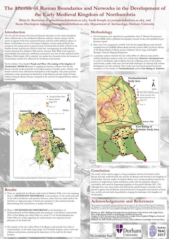
The People and Place team recently presented a poster at TRAC 2017. The 27th annual Theoretical Roman Archaeology Conference (TRAC) was hosted by the Department of Archaeology and the Department of Classics and Ancient History at Durham University from the 28th to 31st of March, 2017. TRAC is a multidisciplinary symposium focused on theoretical approaches to Roman studies, and is one of the largest gatherings of Roman scholars in the world. The People and Place team presented a poster entitled ‘The Afterlife of Roman Boundaries and Networks in the Development of the Early Medieval Kingdom of Northumbria.’ The poster presented at TRAC 2017 examined the distribution of late Roman and early medieval burial evidence from our database and compared this to the network of mapped Roman roads in Northumbria. While it has long been acknowledged that prehistoric and Roman monuments were foci of early medieval activity, relatively few studies have focused on how the locations of burials within the boundaries of the kingdom of Northumbria were influenced by the Roman road network.
The 542 site locations currently in the People and Place database were analysed using ArcGIS 10.2. The sites were compared to a Roman road network mapped from combining the results of DARMC Roman Road network project (version 2008), the Secret History of the Roman Roads of Britain project, Ordnance Survey maps, and English Heritage’s National Mapping Programme. A proximity analysis extracted the burial sites within 500m of a Roman road, and the resulting distribution pattern results were tested using a Pearson’s chi-squared test. As many of the Roman roads in Britain form the underlying modern road network, smaller study areas containing stable landscapes of relatively little modern development were also investigated using the historic boundaries of Northumberland and the East Riding of Yorkshire.
The results demonstrate a significant difference in the proximity of burial sites north and south of Hadrian’s Wall in comparison to the Roman road network, with the sites south of the wall in general positioned closer to the road network. This is perhaps not surprising as there are significantly less Roman roads north of the wall. However, where there are roads north of the wall, there is a high percentage of burial sites proximate to these limited networks, demonstrating their attractiveness as markers for burial. This was further supported in the analysis of the smaller study areas which demonstrated no significant differences in the distribution of Northumberland and East Riding burial sites proximate to Roman road networks. Finally, the majority of the sites within 500m of the Roman road network were in visual proximity of the roads based off of a viewshed analysis using the 5m digital terrain model of the project area.
The results of this analysis, while preliminary, suggest a strong correlation between the location of late Roman and early medieval burial sites and the Roman road network in the kingdom of Northumbria – something we plan to investigate further.

 RSS Feed
