I recently had the pleasure of accompanying a Durham University undergraduate, Darren Oliver, to the early medieval royal vill at Yeavering in order to conduct an aerial photographic survey of the site and its immediate environs. Darren is currently undertaking a systematic survey of the site for his undergraduate dissertation. He has constructed his own unmanned aerial vehicle (UAV), or drone, to take multi-spectral imagery of the landscape to determine if archaeological features are visible at different times of the year. Yeavering is located on a sand and gravel plateau overlooking the River Glen and in the shadow of Yeavering Bell along the northern limits of the Cheviot Hills. The royal palace complex of Yeavering, or Ad Gefrin, is discussed by Bede in his History of the English Church and People as the place where the missionary Paulinus accompanied the king and queen of Northumbria in AD 627 to instruct and baptize the local populace (HE II, 14). Yeavering was identified by aerial reconnaissance in 1949 (Knowles and St Joseph 1952, 270-1) and was excavated throughout the 1950s and 60s by Dr Brian Hope-Taylor (Hope-Taylor 1977). These landmark excavations revealed multiple phases of settlement from the early medieval period, and are considered a seminal moment in British field archaeology due to the methods used by Hope-Taylor and the fact that Yeavering is a type-site for understanding early medieval palace complexes. It is an important site for the People and Place project, as numerous burials were excavated by Hope-Taylor, and were assigned to pre- and post-Christian contexts. As such I was interested in learning more about UAV flights and their potential in revealing early medieval burials and cemeteries.
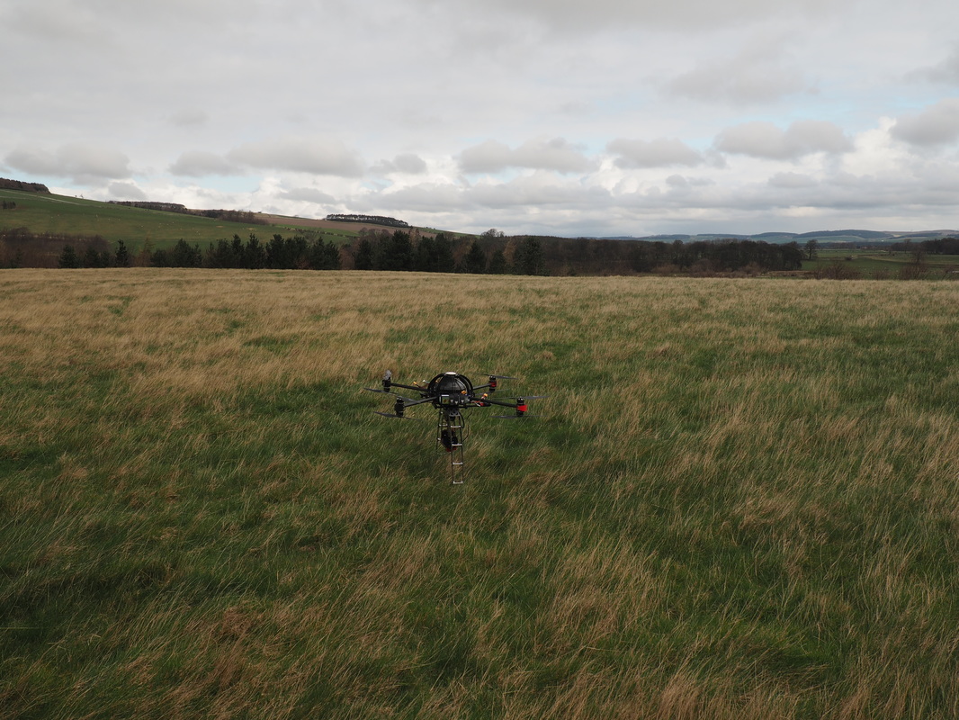
UAV ready to fly, resting within the boundary's of the site.
The use of aerial drones to survey the archaeological landscape is a burgeoning technique in archaeological investigation, recording, and analysis. Aerial photography has a long and important history in the archaeology of Britain, as attested to by the discovery of Yeavering and other sites in Northumberland through cropmarks, parchmarks, and soilmarks. One of the primary down-sides of traditional aerial photography is the cost and training required to either commission flights or to undertake the training to be a pilot. The growth in UAVs over the last decade has provided a more affordable way to conduct aerial surveys, and has only recently been incorporated into archaeological methods and practice. Darren’s work at Yeavering is concentrating on examining the archaeological landscape by focusing on taking photography outside the visual spectrum and investigating the reflectivity of the vegetation to identify archaeological features. He has conducted a systematic survey of the site by conducting flights every month throughout the year to determine if seasonal changes to vegetation and weather affect the visibility of archaeological features. Although additional burial evidence has not been identified through these surveys, new anomalies that are potentially related to the archaeological heritage of the site have been identified through his work at the site.
The use of aerial drones to survey the archaeological landscape is a burgeoning technique in archaeological investigation, recording, and analysis. Aerial photography has a long and important history in the archaeology of Britain, as attested to by the discovery of Yeavering and other sites in Northumberland through cropmarks, parchmarks, and soilmarks. One of the primary down-sides of traditional aerial photography is the cost and training required to either commission flights or to undertake the training to be a pilot. The growth in UAVs over the last decade has provided a more affordable way to conduct aerial surveys, and has only recently been incorporated into archaeological methods and practice. Darren’s work at Yeavering is concentrating on examining the archaeological landscape by focusing on taking photography outside the visual spectrum and investigating the reflectivity of the vegetation to identify archaeological features. He has conducted a systematic survey of the site by conducting flights every month throughout the year to determine if seasonal changes to vegetation and weather affect the visibility of archaeological features. Although additional burial evidence has not been identified through these surveys, new anomalies that are potentially related to the archaeological heritage of the site have been identified through his work at the site.
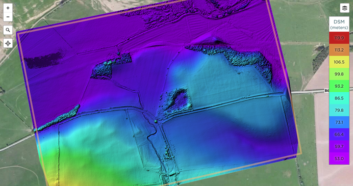
Digital surface model of Yeavering and environs derived from photogrammetry of UAV imagery
It was my first time seeing a UAV in action, and I was impressed at the abilities of the drone to survey the landscape both efficiently and quickly. As well as the ability to take high resolution RGB photos and multi-spectral images, drone photography can be used to model the topographic elevation of a landscape utilising photogrammetry. In addition, drones can be adapted to use LiDAR scanners in order to produce highly-detailed elevation models. Many thanks are necessary to Darren for demonstrating his drone and for his work at the site, which will be invaluable for understanding the archaeological environs of the site. Darren has taken drone flights at other archaeological sites in the region, and is keen to continue this work after his degree is finished at Durham for any other archaeologists working in Britain that would benefit from these techniques.
You can see more of Darren’s work at: https://sketchfab.com/dojpot
Knowles, David, and John Kenneth Sinclair St Joseph.Monastic sites from the air. University Press, 1952.
Hope-Taylor, Brian. Yeavering, an Anglo-British centre of early Northumbria. HM Stationery Office., 1977.


 RSS Feed
