People & Place: The making of the kingdom of Northumbria
  • Home
    • Meet the Team
  • About
    • Mapping the Data
  • Blog
  • Links
  • County Durham Data

Mapping burials in Northumbria: a chance to input to the project

10/10/2017

3 Comments

 
​People and Place is charting the entirety of the burial record for the kingdom of Northumbria at its greatest possible extent. We are two years in to our project and have now reached the final stages of data collection. Our database records all archaeologically attested early medieval burials within the kingdom at its largest extent currently includes approximately 550 sites and +3000 individuals. The sites, individuals, and associated artefacts are all logged within our access database, allowing us to spatially map relationships between these sites and the natural and human altered landscape, within localities and across regions.
Picture
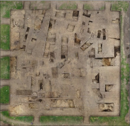
Aerial photograph of excavations of Binchester cemtery. 2017, ​ © David Petts

This month we are releasing a pilot sample and we’d like your opinion on how accessible this data is, how usable and how we might improve our online delivery. We’ve chosen to offer you our mortuary data from the County of Durham. This blog will take you via this link to a new page on our website: County Durham Data. Here users will find three tables presented as .pdfs – these list the sites, the individual burials from these sites and the artefacts that were recovered with those burials. Three information sheets are also present to help users navigate the lists and use them to identify information about locations, individual graves and artefacts. We have also produced sample maps: a basic plot of sites, the sites mapped in relation to elevation, to rivers and to Roman roads. So please ‘dig in’! We are very keen to receive feedback on the usability so we can shape our ultimate release of all data online. We’d like to hear your views before the 1st of December 2017. Please send all your comments to Brian at b.g.buchanan@durham.ac.uk. 

3 Comments

    Authors

    Dr Brian Buchanan, Dr Sue Harrington, Prof Sarah Semple, Dr Stuart Brookes
    ​

    Archives

    February 2018
    November 2017
    October 2017
    May 2017
    April 2017
    June 2016
    February 2016
    December 2015
    October 2015

    Categories

    All
    GIS
    Landscape
    Mapping

    RSS Feed

Powered by Create your own unique website with customizable templates.